This exhibit is an online version of a few of the Then & Now pairings we’ve done over the years in slideshows, exhibits, and now in our book “Charlottesville Then & Now.” In the selection below the old photographs include a wide range of dates from the 1800s to the 1970s and are paired up with current era images of the same location, providing a fascinating look at the changes over time. As the viewer will see, some things change dramatically while others are remarkably unchanged. This display uses a “slider” device which allows the viewer to move between the past and present. Click and drag the arrows left or right to view both images.
“Then & Now” is just one of several rotating exhibits you will find here on our website. Check back often for new exhibits and occasional changes and updates to current exhibits.
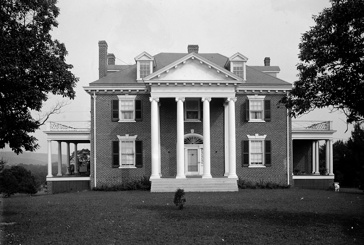
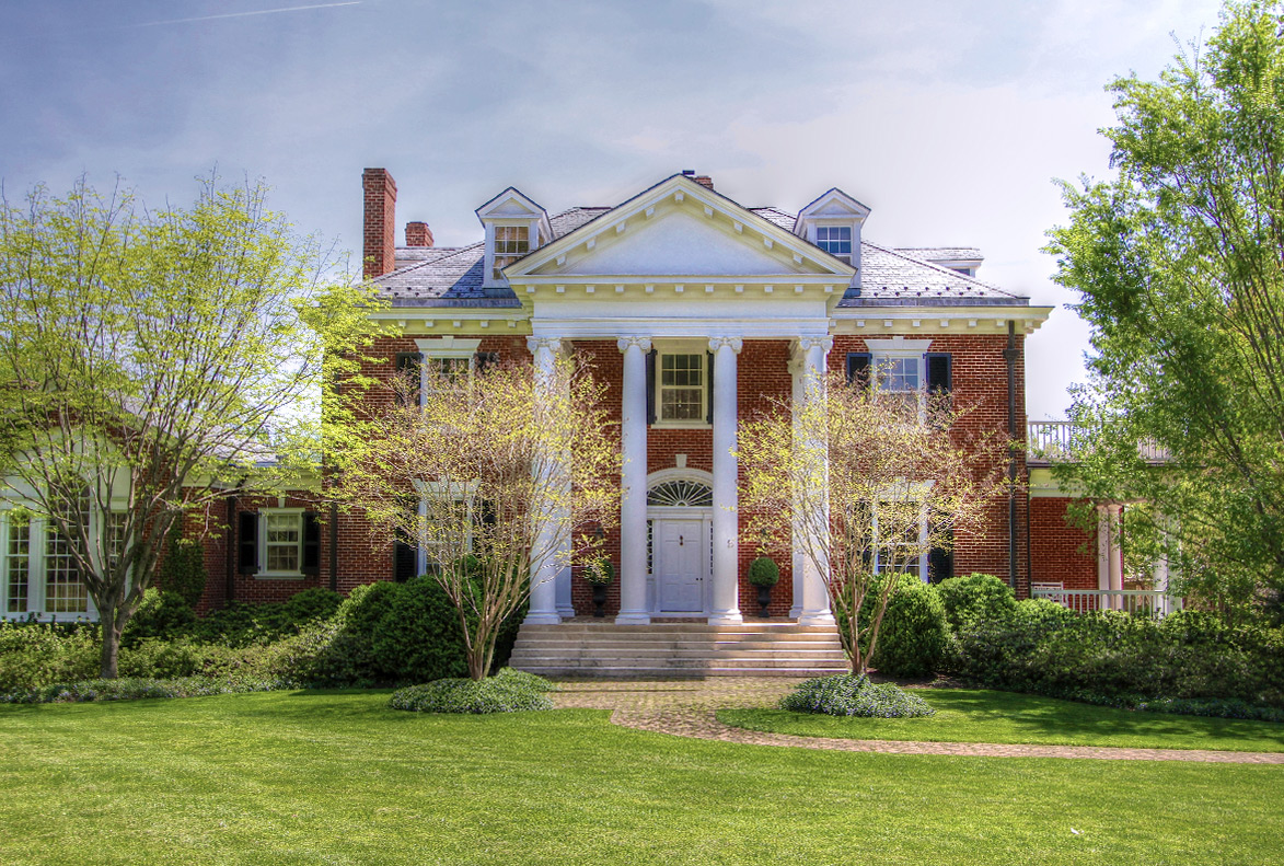
“Four Acres” on Rugby Road is a large estate built circa 1910 and designed by architect Eugene Bradbury who has many notable homes and buildings around Charlottesville and UVA to his name. “Four Acres” sits on just under 4 acres, but is still one of the largest lots within the city limits. The vintage photo seen here was taken by Rufus Holsinger in 1914 (courtesy Special Collections, UVA Library) and the more recent photo was taken by C’ville Images in 2011 when we photographed the property after an extensive renovation. The estate has had several owners over the years including Admiral William “Bull” Halsey, a highly-regarded naval commander in the South Pacific during WWII, who lived here after the war, having attended UVA early in his career. (Side note: Admiral Halsey is referenced in the Paul McCartney song “Uncle Albert/Admiral Halsey” with its familiar “Hands across the water” refrain.) Four Acres is currently on the market for sale.
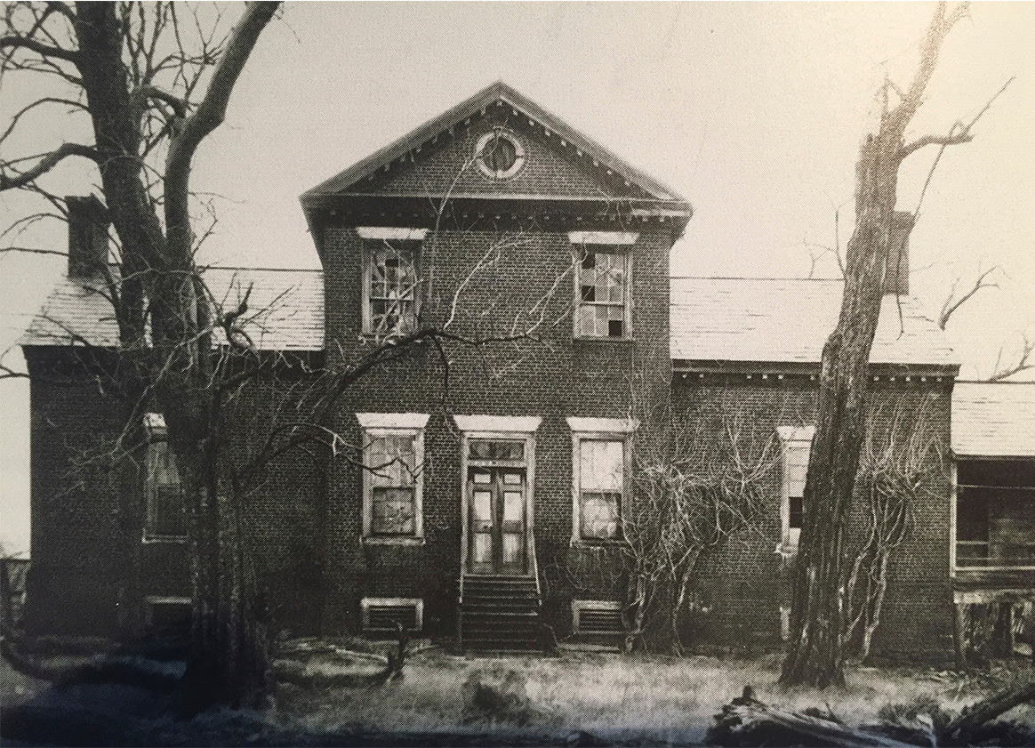
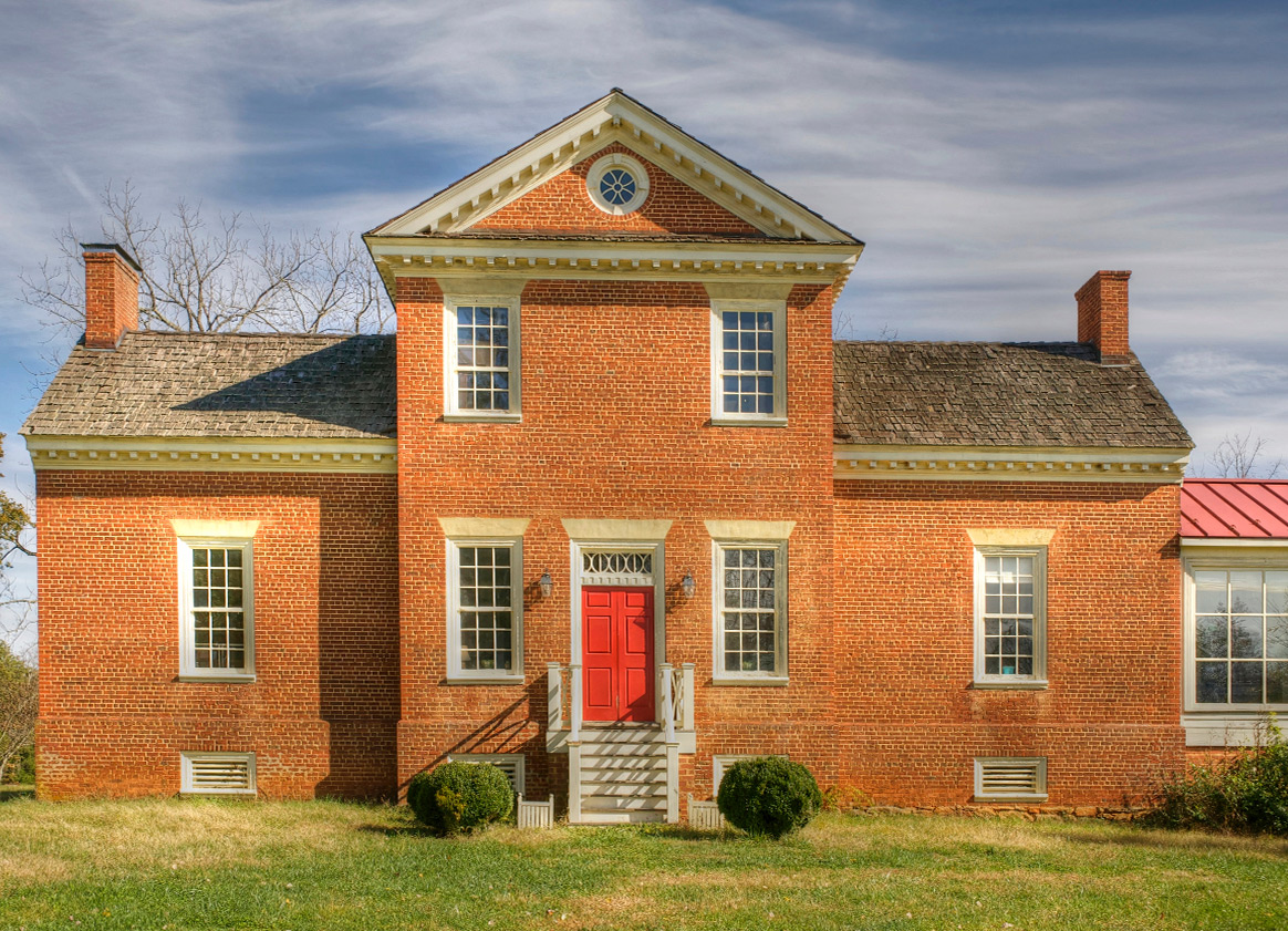
This southern Albemarle home named Mountain Grove is one of the oldest estates in the county, built in 1804 by a former Revolutionary War captain, Benjamin Harris. The tripartite design is seen in other Albemarle County homes from the period. This impressive brick house has had its periods of neglect but today stands preserved, very close to its original design.
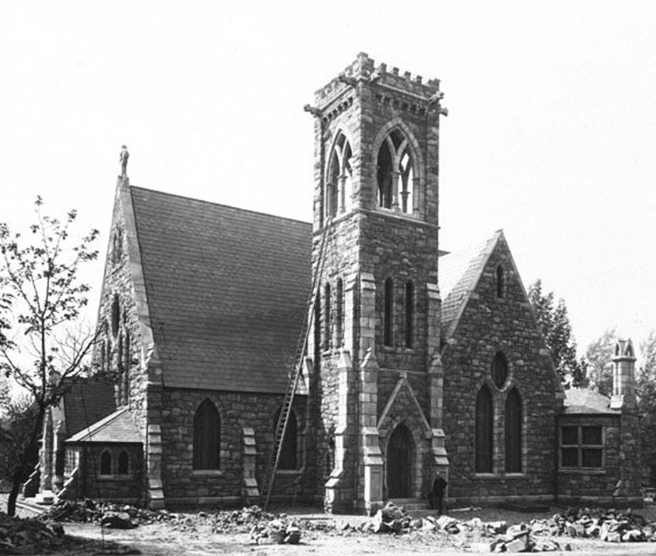
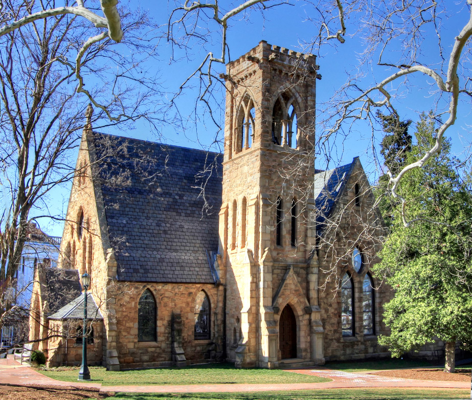
One of the earliest photographs of the Chapel at UVA, this 1889 photo by J.T. Wampler shows the Chapel under construction. It opened in 1890 and with its gothic windows, rough-cut stone, and gargoyles on the bell tower, and stood in stark contrast to the red bricks and columns of the Jeffersonian architecture throughout the Academical Village. Interestingly, Jefferson did not include a chapel in his original plans for the University. The second image shows the Chapel virtually unchanged 125 years later.
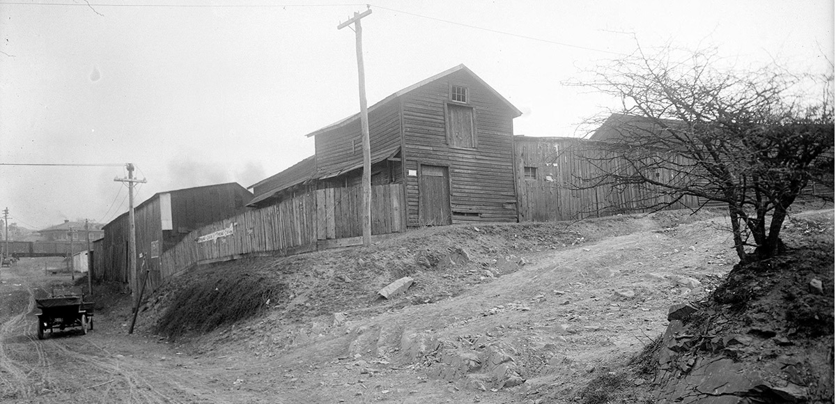
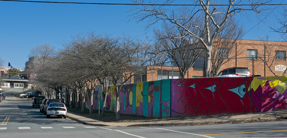
The corner of Garrett and 6th Streets, SE in Charlottesville. The earlier photo was taken over 100 years ago and shows the treacherous terrain of some of the city’s streets back then when both automobiles and horse-drawn carts shared the roads. This part of town contained both residential and industrial properties including many warehouses, only three blocks south of Main Street, today’s downtown pedestrian mall. In both photos you can see the C&O Railroad depot building (in the distance, up 6th St.) which was built in 1905 (although a railroad depot at that location goes back another half-century). Vintage image courtesy Special Collections, UVA Library.
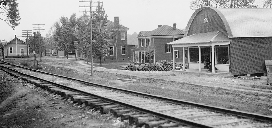
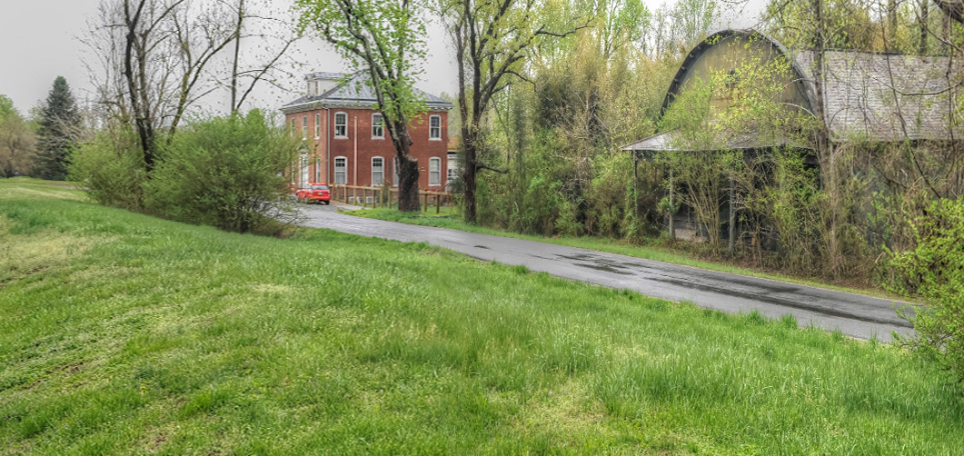
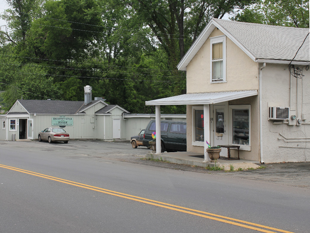
Esmont in southern Albemarle County is a small town named after the nearby plantation. The older picture shows the railroad and depot which are now long gone. Other buildings, seen in the photograph from a century ago, still exist (in various conditions) in this small rural community.
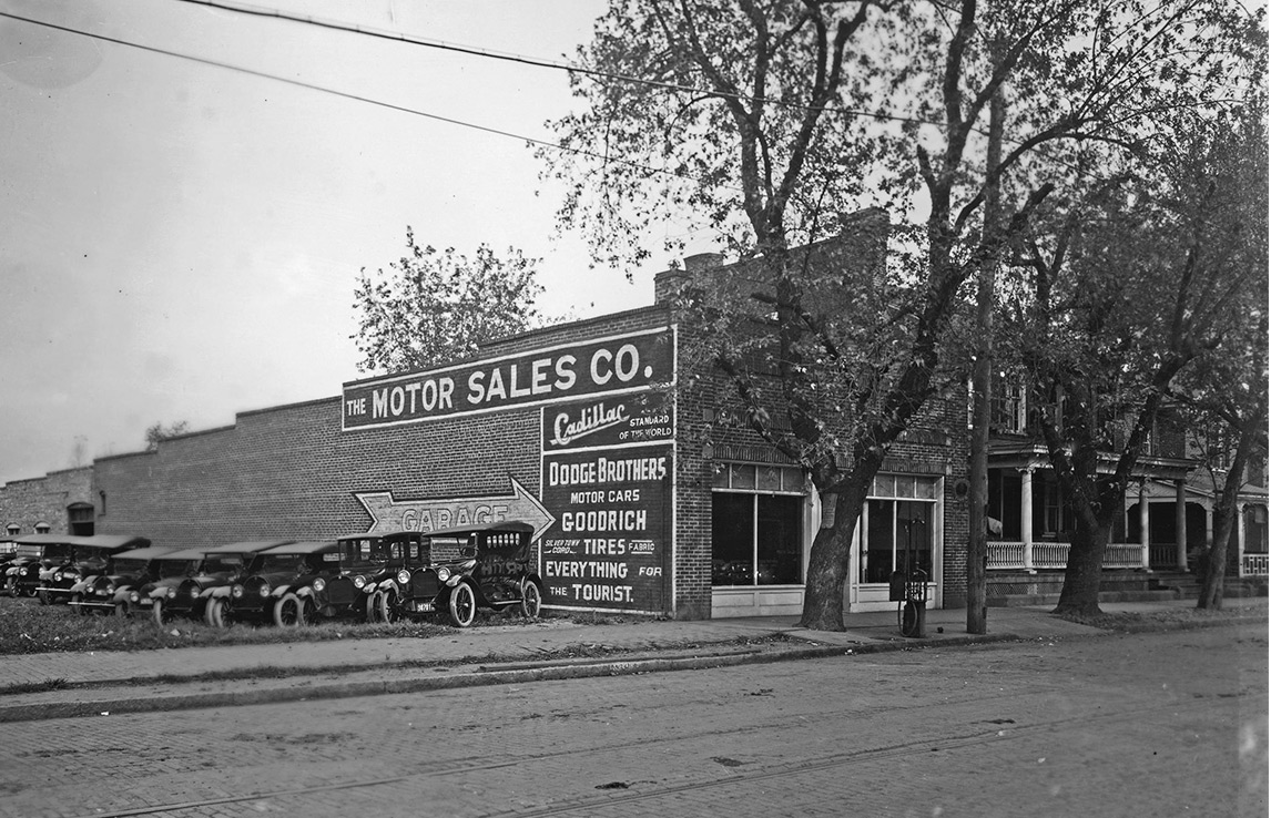
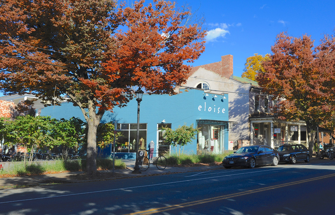
The older photograph shows a car dealership on West Main Street in the early 1900s. The building, though changed, still exists. The adjacent houses also still stand more than 100 years later. Note the brick pavement and trolley tracks running down the center of the street in the earlier photo.
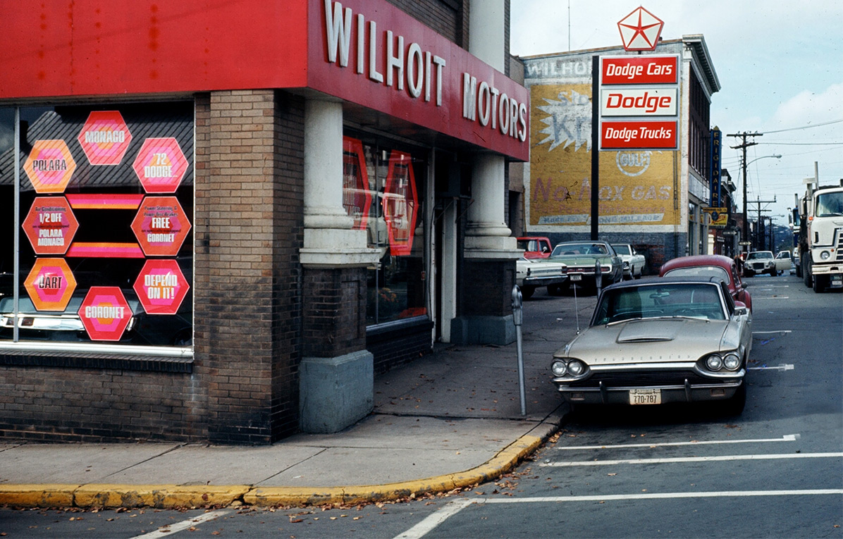
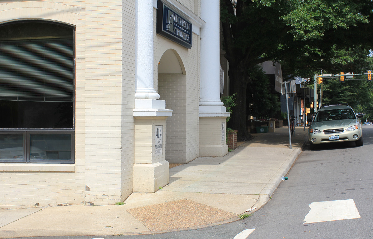
These photos show East Market Street at the corner of 5th Street. The earlier photo was taken in 1971 when Wilhoit Motors had a showroom and garage there, storing many of the automobiles on the roof. The building now contains office space. Car dealerships in Downtown Charlottesville were commonplace throughout the middle part of the 20th Century but slowly the dealerships migrated to West Main Street, and later 29 North and Pantops in search of larger car lots.
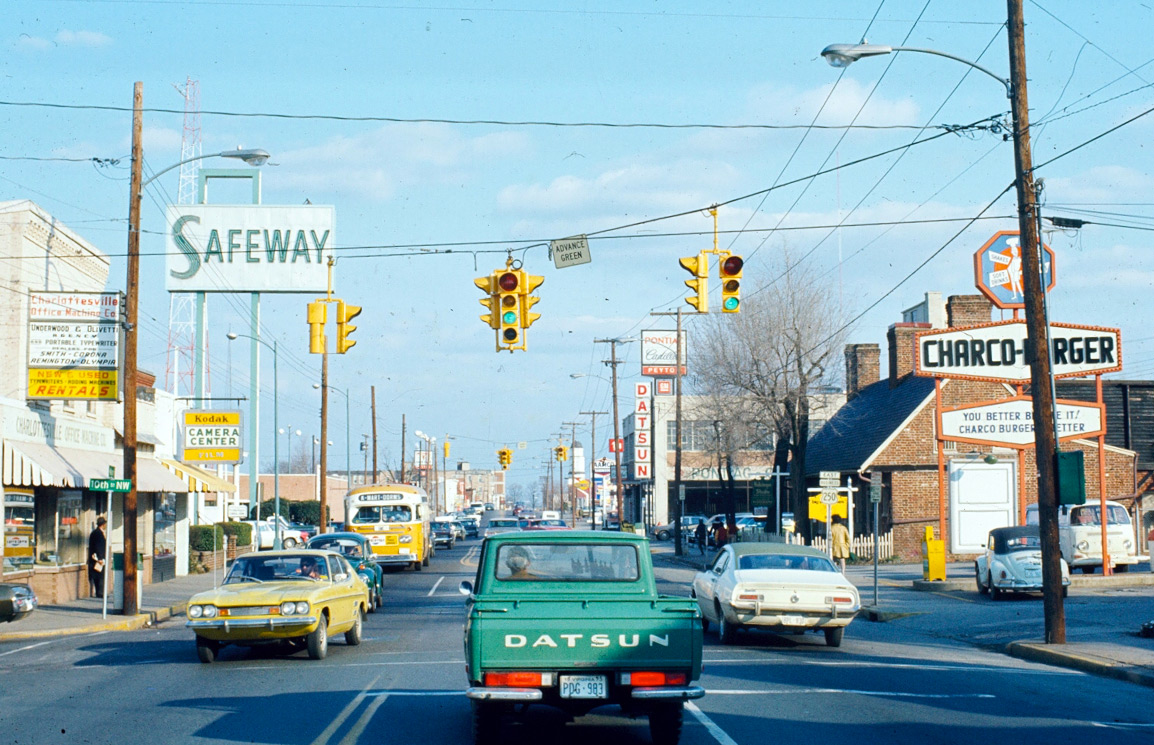
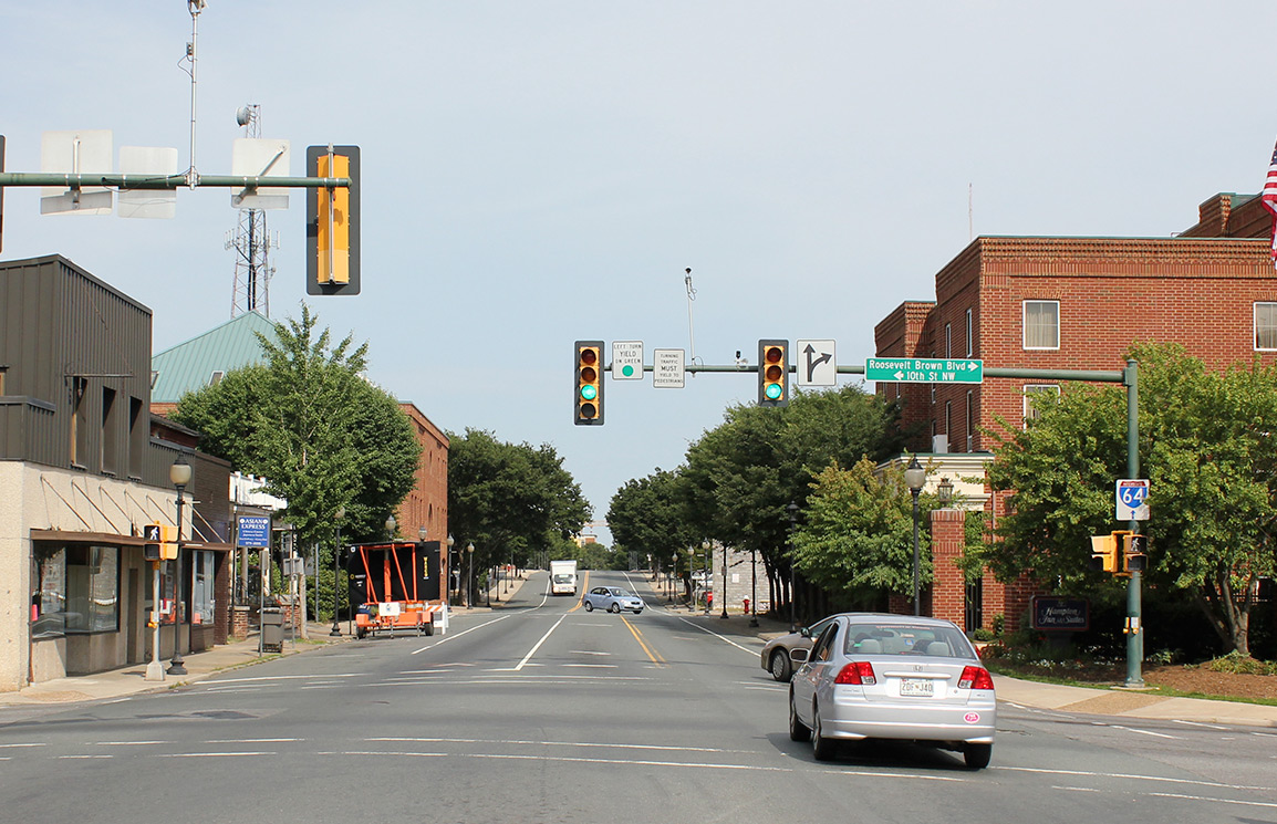
West Main Street, looking east, from the intersection with 10th Street. The earlier image is from sometime in the 1970s and the recent photo from the 2010s. The view has changed even more dramatically in the past couple of years.
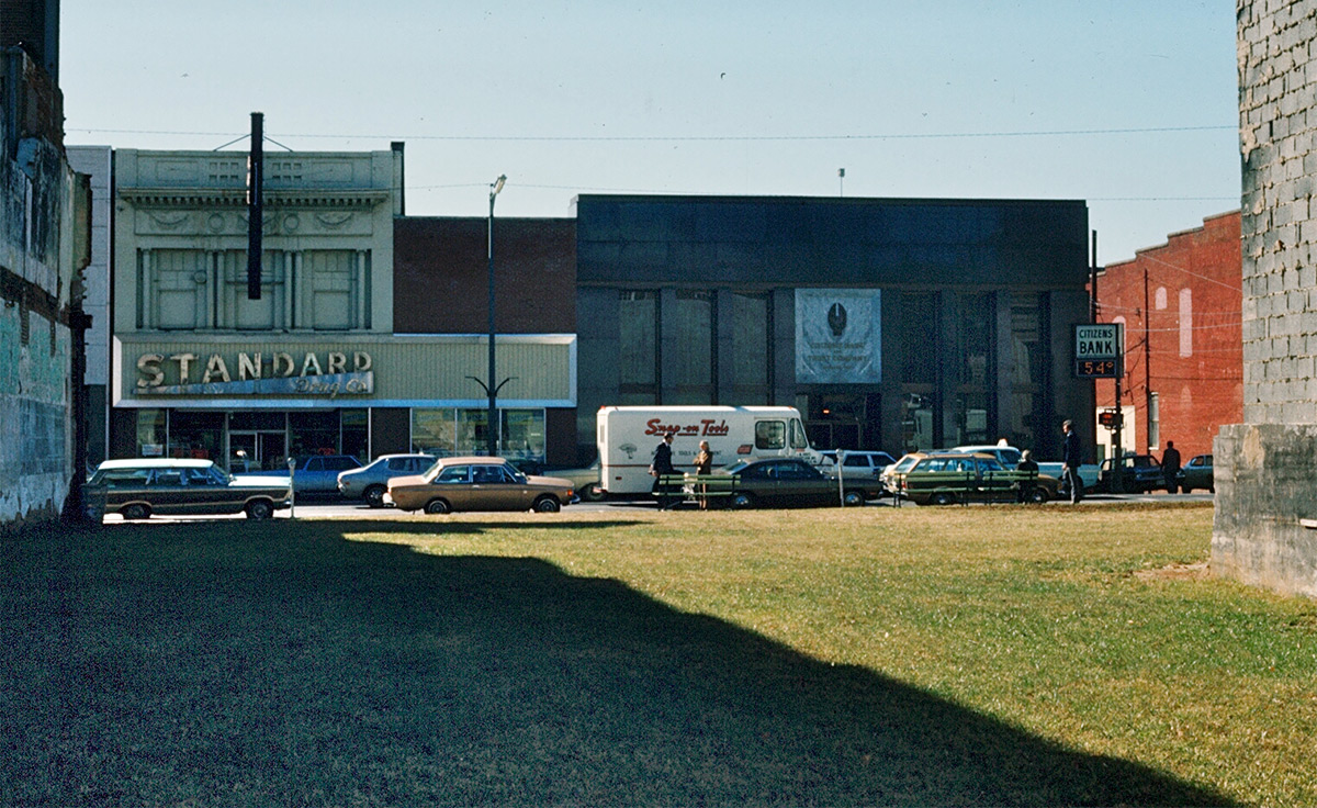
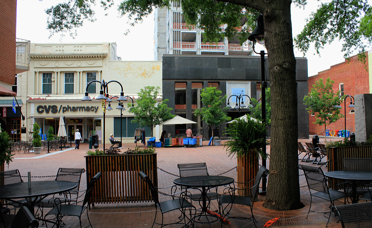
The earlier photograph here was taken sometime after the 1973 fire that claimed McCrory’s and the neighboring businesses on Main Street, but before the downtown pedestrian mall was built a couple of years later. The buildings on the south side of East Main are still easily identified, and the grassy, empty lot is now Central Place, accommodating outdoor seating for the shops and restaurants nearby. The Standard Drug has become a CVS but the architectural detailing on the second story of that building remains unchanged. The Citizens Bank on the the corner in the 1970s image is now the unfinished and abandoned Landmark Hotel project.
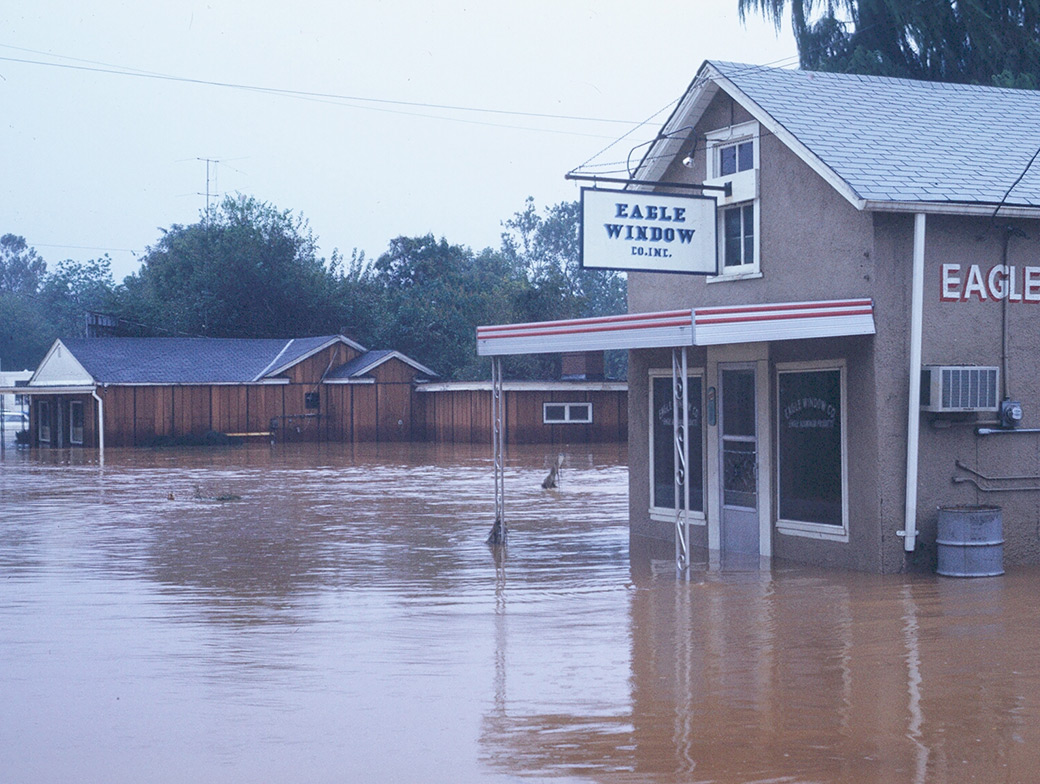
The older photo seen here was taken on East High Street in the summer of 1972 when the Rivanna River overflowed its banks. By the time it reached Virginia, Hurricane Agnes was only a tropical depression, but it still dumped more than 7 inches of rain on Charlottesville on June 22. Including the previous day’s rains it was closer to 10 inches in total according to the weather service records. Although Charlottesville didn’t get the worst of it (Central PA got more than 15 inches), the local flooding and devastation was significant. Hurricane Agnes was the most costly in terms of dollars the U.S. had seen up to that point. In Scottsville, VA the flooding that came with Agnes holds the record, 4 feet higher than even Camille, the devastating storm that hit Central Virginia just three years earlier. The “now” image was taken in 2012.
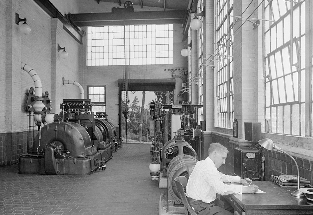

The Charlottesville & Albemarle Railway Power Plant near Woolen Mills, circa 1914, shortly after it was built. The plant’s proximity to the river allowed for use of water to operate the steam turbines. It’s proximity to the railroad allowed for delivery of coal. The plant produced electricity which was used primarily to operate an electric streetcar system running between downtown Charlottesville and the University of Virginia. The more recent shot shows it again about a century later, completely abandoned. (B&W image courtesy Special Collections, UVA Library)
This series was created by Steve Trumbull and Steve Haske.
All images are from the C’ville Images archives, except where noted.
©C’ville Images
Our 2017 book, Charlottesville Then & Now contains dozens of these “then & now” pairings. This popular book is sold out with no current plans to reprint.
This exhibit is an online version of a few of the Then & Now pairings we’ve done over the years in slideshows, exhibits, and now in our book “Charlottesville Then & Now.” In the selection of pairings below the old photographs include a wide range of dates from the 1800s to the 1970s and are paired up with current era images of the same location. Then & Now pairings are a fascinating way to see the change of a building, location or landmark over time. As the viewer will see, some things change dramatically while others are remarkably unchanged. This display uses a “slider” device which allows the viewer to move between the past and present. “Pull” the arrows left or right to view two images.